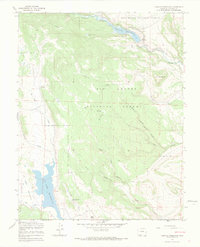
1967 Map of Terrace Reservoir
USGS Topo · Published 1970About this map
La Jara Reservoir and Terrace Reservoir anchor this landscape within the Rio Grande National Forest, illustrating the vital water management systems of high-altitude Colorado. The presence of Shawcroft Cow Camp and Baxter and Martin Cow Camp points to the seasonal grazing patterns central to the regional economy during the late 1960s. High country movement is further evidenced by the Stock Driveway north of the Alamosa River and various Jeep Trails that traverse the complex network of canyons and ridges. Between the water bodies, the terrain is deeply incised by drainages like Hot Creek and Piedrosa Creek, with landmarks such as Bald Ridge and Jacobs Hill rising above the timbered slopes. This 1967 field-checked survey provides a precise record of these livestock outposts and the natural hydrology of the San Juan Mountains before later developments altered the backcountry character.
Find a feature on this map
23 named features on this map. Tap any name to fly to it.
Don’t see what you’re looking for? This feature index may not catch every label — zoom into the map to look around manually.
Map Details
Editions of this 1967 Terrace Reservoir Map
4 editions found
Other maps of this area

1922 · Conejos
USGS Topo · 1:125,000

1945 · Durango
USGS Topo · 1:250,000

1953 · Durango
USGS Topo · 1:250,000

1954 · Durango
USGS Topo · 1:250,000

1961 · Durango
USGS Topo · 1:250,000

1963 · Durango
USGS Topo · 1:250,000

1966 · Durango
USGS Topo · 1:250,000
1967 · Spectacle Lake
USGS Topo · 1:24,000
1967 · La Jara Canyon
USGS Topo · 1:24,000
1967 · Jasper
USGS Topo · 1:24,000