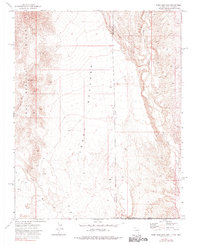
1973 Map of Terry Benches
USGS Topo · Published 1980About this map
The Terry Benches define a high plateau landscape where Nevada, Utah, and Arizona meet. This 1970s era survey captures the complex drainage systems of the desert, dominated by Beaver Dam Wash and its tributaries like Reber Wash and Burgess Wash. The mapping of these intermittent waterways across the rugged Tule Springs Hills illustrates the primary geological forces shaping this tri-state corner.
Find a feature on this map
14 named features on this map. Tap any name to fly to it.
Don’t see what you’re looking for? This feature index may not catch every label — zoom into the map to look around manually.
Map Details
Editions of this 1973 Terry Benches Map
2 editions found
Other maps of this area

1885 · St. George
USGS Topo · 1:250,000

1885 · Pioche
USGS Topo · 1:250,000

1886 · Saint Thomas
USGS Topo · 1:250,000

1886 · Mt. Trumbull
USGS Topo · 1:250,000

1886 · Pioche
USGS Topo · 1:250,000

1891 · St. George
USGS Topo · 1:250,000

1892 · Mt. Trumbull
USGS Topo · 1:250,000

1893 · Saint Thomas
USGS Topo · 1:250,000

1953 · Cedar City
USGS Topo · 1:250,000

1953 · Grand Canyon
USGS Topo · 1:250,000