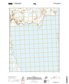
2020 Map of Teshekpuk D-5 NW
USGS Topo · Published 2020About this map
The Meade River winds through this coastal Arctic landscape on the North Slope of Alaska, meeting the complex network of lagoons and wetlands that define the shoreline. This 2020 survey illustrates the dynamic hydrologic patterns of the region, where the river's path eventually nears the Beaufort Sea. Significant coastal features like McTavish Point serve as primary landmarks in an area dominated by intricate water systems and shifting wetlands. The map provides a detailed view of the terrain within the North Slope Borough, illustrating the vast expanse of the National Petroleum Reserve and its characteristic permafrost-influenced geography.
Find a feature on this map
6 named features on this map. Tap any name to fly to it.
Don’t see what you’re looking for? This feature index may not catch every label — zoom into the map to look around manually.
Map Details
Editions of this 2020 Teshekpuk D-5 NW Map
This is the sole edition of this map. No revisions or reprints were ever made.
Other maps of this area

1945 · Barrow
USGS Topo · 1:250,000

1949 · Barrow
USGS Topo · 1:250,000

1951 · Meade River
USGS Topo · 1:250,000

1951 · Teshekpuk
USGS Topo · 1:250,000

1955 · Barrow A-2
USGS Topo · 1:63,360

1955 · Barrow
USGS Topo · 1:250,000

1955 · Teshekpuk
USGS Topo · 1:250,000

1955 · Meade River
USGS Topo · 1:250,000

1955 · Barrow A-3
USGS Topo · 1:63,360
1955 · Teshekpuk D-5
USGS Topo · 1:63,360