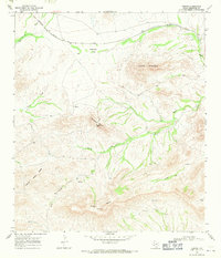
1968 Map of Tesnus
USGS Topo · Published 1971About this map
Southern Pacific tracks cut through this high desert terrain in the late 1960s, linking the small rail siding of Tesnus with the broader Trans-Pecos region. The landscape is defined by its dramatic topographic relief, dominated by the massive Castle Mountain in the northeast and the series of summits known as Panther Peaks and Shely Peaks to the south. Between these heights, the land drops into the evocative Hells Half Acre, a complex of steep drainage and broken ground that illustrates the severe erosion patterns of the Chihuahuan Desert. Seasonal watercourses like China Draw, Maxon Creek, and Alamo Creek carve deep paths through the limestone, while the presence of Copeland Trap and isolated Spring sites point to the region's enduring history of ranching and resource management in a sparse environment.
Find a feature on this map
20 named features on this map. Tap any name to fly to it.
Don’t see what you’re looking for? This feature index may not catch every label — zoom into the map to look around manually.
Map Details
Editions of this 1968 Tesnus Map
2 editions found

Other maps of this area

1917 · Hood Spring
USGS Topo · 1:62,500

1918 · Bone Spring
USGS Topo · 1:125,000

1918 · Hood Spring
USGS Topo · 1:62,500

1918 · Dove Mountain
USGS Topo · 1:62,500

1920 · Longfellow
USGS Topo · 1:125,000

1920 · Marathon
USGS Topo · 1:62,500

1921 · Marathon
USGS Topo · 1:62,500

1931 · Hood Spring
USGS Topo · 1:62,500

1954 · Fort Stockton
USGS Topo · 1:250,000

1958 · Fort Stockton
USGS Topo · 1:250,000