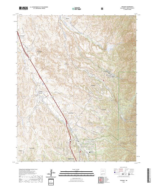
2023 Map of Tesuque
USGS Topo · Published 2023About this map
Tesuque Pueblo and the historic Cuyamungue Grant anchor this landscape north of Santa Fe, where high desert arroyos meet the western edge of the Santa Fe National Forest. The map documents a complex network of traditional water management and mountain drainage, including the Mitchell Ditch and numerous seasonal watercourses like Arroyo Cuyamungue and Arroyo Cuma. Modern residential development is evident in settlements such as Chupadero, En Medio, and Encantado, which are tucked into the valleys between rising terrain.
Find a feature on this map
89 named features on this map. Tap any name to fly to it.
Don’t see what you’re looking for? This feature index may not catch every label — zoom into the map to look around manually.
Map Details
Editions of this 2023 Tesuque Map
This is the sole edition of this map. No revisions or reprints were ever made.
Other maps of this area

1889 · Santa Fe
USGS Topo · 1:125,000

1892 · Santa Clara
USGS Topo · 1:125,000

1894 · Santa Fe
USGS Topo · 1:125,000

1951 · Agua Fria
USGS Topo · 1:24,000

1952 · Santa Fe
USGS Topo · 1:24,000

1953 · Tesuque
USGS Topo · 1:24,000

1953 · Espanola
USGS Topo · 1:24,000

1953 · Horcado Ranch
USGS Topo · 1:24,000

1953 · Sierra Mosca
USGS Topo · 1:24,000
1953 · Cundiyo
USGS Topo · 1:24,000