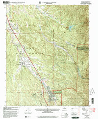
2002 Map of Tesuque
USGS Topo · Published 2003About this map
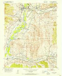
Tesuque Pueblo serves as a central point in this northern New Mexico landscape, surrounded by the historical boundaries of the Tesuque Pueblo Grant and the Nambe Indian Reservation. The map details the local infrastructure supporting these communities, from the Tesuque Pueblo Day School and San Diego Ch to the Sewage Disposal Ponds along the Rio Tesuque. The terrain is marked by significant natural and cultural landmarks, including the distinctive Camel Rock and the Nambe Falls Reservoir fed by Nambe Falls. Residential areas and developments like South Tesuque, Chupadero, and Casas De San Juan are mapped alongside traditional land grants, showing the modern footprint of these ancestral territories at the turn of the 21st century. The complex network of arroyos, such as Arroyo Cuyamungue and Arroyo Cuma, illustrates the drainage patterns vital to this high-desert environment.
Find a feature on this map
36 named features on this map. Tap any name to fly to it.
Don’t see what you’re looking for? This feature index may not catch every label — zoom into the map to look around manually.
Map Details
Editions of this 2002 Tesuque Map
This is the sole edition of this map. No revisions or reprints were ever made.
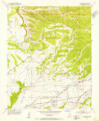
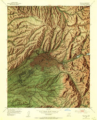
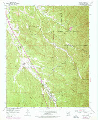
Other maps of this area

1889 · Santa Fe
USGS Topo · 1:125,000

1892 · Santa Clara
USGS Topo · 1:125,000

1894 · Santa Fe
USGS Topo · 1:125,000
1951 · Agua Fria
USGS Topo · 1:24,000
1952 · Santa Fe
USGS Topo · 1:24,000
1953 · Tesuque
USGS Topo · 1:24,000
1953 · Espanola
USGS Topo · 1:24,000
1953 · Horcado Ranch
USGS Topo · 1:24,000
1953 · Sierra Mosca
USGS Topo · 1:24,000
1953 · Cundiyo
USGS Topo · 1:24,000