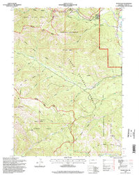
1996 Map of Teton Pass
USGS Topo · Published 1998About this map
Teton Pass stands as the central landmark of this mid-1990s survey, marking a critical crossing between the Teton Range and the Snake River Range. The settlement of Wilson appears at the northeastern edge of the sheet, served by the Trail Creek Road and surrounded by established seasonal properties like the Trail Creek Ranch and the Black Canyon Summer Home Area. High-altitude features including the Glory Slide and a Microwave Station reflect the mountain-pass infrastructure, while the Elliott Cem near Wilson provides a specific point of interest for family historians.
Find a feature on this map
41 named features on this map. Tap any name to fly to it.
Don’t see what you’re looking for? This feature index may not catch every label — zoom into the map to look around manually.
Map Details
Editions of this 1996 Teton Pass Map
This is the sole edition of this map. No revisions or reprints were ever made.
Other maps of this area

1899 · Grand Teton
USGS Topo · 1:125,000

1901 · Grand Teton
USGS Topo · 1:125,000

1931 · Jackson
USGS Topo · 1:125,000

1932 · Irwin
USGS Topo · 1:96,000

1935 · Irwin
USGS Topo · 1:125,000

1935 · Jackson
USGS Topo · 1:125,000

1943 · Driggs
USGS Topo · 1:62,500

1946 · Driggs
USGS Topo · 1:62,500

1955 · Driggs
USGS Topo · 1:250,000

1958 · Driggs
USGS Topo · 1:250,000