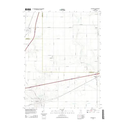
2015 Map of Teutopolis
USGS Topo · Published 2015About this map
Teutopolis and the surrounding agricultural landscape of southeastern Illinois are defined by a dense network of country roads and family-named cemeteries. This mid-2010s survey captures the region where the borders of Shelby, Cumberland, and Effingham counties meet. Smaller settlements like Lillyville and Sigel are connected by a grid of numbered roads, including E 2050th Ave and N 100 East Rd, while the larger corridor of Interstate 70 passes through Montrose. The terrain is etched by the intricate drainages of First Salt Creek, Second Salt Creek, and Spring Point Creek, which carve subtle valleys through the farmland. Genealogists will find significant value in the documentation of local burial sites, such as Saint Francis Cem and Needham Cem, which anchor these rural communities to their ancestral roots.
Find a feature on this map
85 named features on this map. Tap any name to fly to it.
Don’t see what you’re looking for? This feature index may not catch every label — zoom into the map to look around manually.
Map Details
Editions of this 2015 Teutopolis Map
This is the sole edition of this map. No revisions or reprints were ever made.
Other maps of this area

1934 · Mattoon
USGS Topo · 1:62,500

1937 · Mattoon
USGS Topo · 1:62,500

1947 · Stewardson
USGS Topo · 1:62,500

1949 · Stewardson
USGS Topo · 1:62,500

1950 · Effingham
USGS Topo · 1:62,500

1951 · Effingham
USGS Topo · 1:62,500

1953 · Teutopolis
USGS Topo · 1:62,500

1958 · Decatur
USGS Topo · 1:250,000

1961 · Decatur
USGS Topo · 1:250,000
1981 · Stewardson East
USGS Topo · 1:24,000