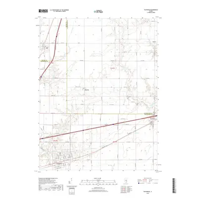
2018 Map of Teutopolis
USGS Topo · Published 2018About this map
Teutopolis anchors the southern portion of this landscape, where the local street grid is defined by W Main St and W Southern Row. The area is characterized by a dense network of country roads and creek drainages, including the branching paths of First Salt Cr and Second Salt Cr. To the north and east, the small communities of Lillyville, Montrose, and Sigel are connected by a mix of historical routes and modern thoroughfares, including segments of the National Rd.
Find a feature on this map
42 named features on this map. Tap any name to fly to it.
Don’t see what you’re looking for? This feature index may not catch every label — zoom into the map to look around manually.
Map Details
Editions of this 2018 Teutopolis Map
This is the sole edition of this map. No revisions or reprints were ever made.
Other maps of this area

1934 · Mattoon
USGS Topo · 1:62,500

1937 · Mattoon
USGS Topo · 1:62,500

1947 · Stewardson
USGS Topo · 1:62,500

1949 · Stewardson
USGS Topo · 1:62,500

1950 · Effingham
USGS Topo · 1:62,500

1951 · Effingham
USGS Topo · 1:62,500

1953 · Teutopolis
USGS Topo · 1:62,500

1958 · Decatur
USGS Topo · 1:250,000

1961 · Decatur
USGS Topo · 1:250,000
1981 · Stewardson East
USGS Topo · 1:24,000