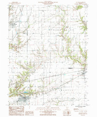
1985 Map of Teutopolis
USGS Topo · Published 1985About this map
Teutopolis anchors this mid-1980s landscape at the southern edge of the survey, where the Illinois Central Gulf tracks run parallel to the southern drainage of Salt Creek. The region is defined by a dense network of prairie drainage systems, including Second Salt Creek and Spring Point Creek, which bisect the agricultural townships of Douglas and St Francis. These waterways historically dictated the placement of early settlements and rural infrastructure before the arrival of modern corridors like Interstate 70.
Find a feature on this map
30 named features on this map. Tap any name to fly to it.
Don’t see what you’re looking for? This feature index may not catch every label — zoom into the map to look around manually.
Map Details
Editions of this 1985 Teutopolis Map
This is the sole edition of this map. No revisions or reprints were ever made.
Other maps of this area

1934 · Mattoon
USGS Topo · 1:62,500

1937 · Mattoon
USGS Topo · 1:62,500

1947 · Stewardson
USGS Topo · 1:62,500

1949 · Stewardson
USGS Topo · 1:62,500

1950 · Effingham
USGS Topo · 1:62,500

1951 · Effingham
USGS Topo · 1:62,500

1953 · Teutopolis
USGS Topo · 1:62,500

1958 · Decatur
USGS Topo · 1:250,000

1961 · Decatur
USGS Topo · 1:250,000
1981 · Stewardson East
USGS Topo · 1:24,000