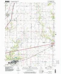
1998 Map of Teutopolis
USGS Topo · Published 2003About this map
Teutopolis anchors the southern portion of this landscape, where the grid of the village meets the meandering path of Salt Creek. The area transitions from the rural townships of Sigel and Douglas in the north toward the concentration of industry and infrastructure near the Illinois Central Railroad. The map reveals a complex water network where Henry Creek, Green Creek, and Spring Point Creek drain the surrounding farmland. In the eastern corridor, the village of Montrose sits near Interchange 105, marking the modern intersection of local settlement and regional transit. Smaller hamlets like Lillyville and Roslyn appear as small clusters of buildings, reflecting the late 20th-century settlement patterns of rural Illinois across the Cumberland and Effingham county lines.
Find a feature on this map
23 named features on this map. Tap any name to fly to it.
Don’t see what you’re looking for? This feature index may not catch every label — zoom into the map to look around manually.
Map Details
Editions of this 1998 Teutopolis Map
This is the sole edition of this map. No revisions or reprints were ever made.
Other maps of this area

1934 · Mattoon
USGS Topo · 1:62,500

1937 · Mattoon
USGS Topo · 1:62,500

1947 · Stewardson
USGS Topo · 1:62,500

1949 · Stewardson
USGS Topo · 1:62,500

1950 · Effingham
USGS Topo · 1:62,500

1951 · Effingham
USGS Topo · 1:62,500

1953 · Teutopolis
USGS Topo · 1:62,500

1958 · Decatur
USGS Topo · 1:250,000

1961 · Decatur
USGS Topo · 1:250,000
1981 · Stewardson East
USGS Topo · 1:24,000