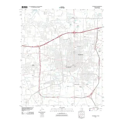
2011 Map of Texarkana
USGS Topo · Published 2011About this map
Texarkana serves as the focal point of this 2011 survey, illustrating the complex urban and industrial footprint along the Texas-Arkansas border. The map details a landscape defined by significant infrastructure, including the Texarkana Regional Airport and the Four States Fair Grounds to the northeast. Beyond the central business district and the Texarkana Post Office, residential expansion is evident in satellite communities like Wake Village and South Texarkana.
Find a feature on this map
60 named features on this map. Tap any name to fly to it.
Don’t see what you’re looking for? This feature index may not catch every label — zoom into the map to look around manually.
Map Details
Editions of this 2011 Texarkana Map
This is the sole edition of this map. No revisions or reprints were ever made.
Other maps of this area

1909 · Texarkana
USGS Topo · 1:62,500

1950 · Ogden
USGS Topo · 1:24,000

1950 · Barkman
USGS Topo · 1:24,000

1951 · Ogden
USGS Topo · 1:24,000

1951 · Barkman
USGS Topo · 1:24,000

1951 · Homan
USGS Topo · 1:24,000

1952 · Mandeville
USGS Topo · 1:24,000

1952 · Fouke
USGS Topo · 1:24,000

1953 · Texarkana
USGS Topo · 1:250,000

1953 · El Dorado
USGS Topo · 1:250,000