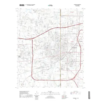
2019 Map of Texarkana
USGS Topo · Published 2019About this map
Texarkana straddles the border between Texas and Arkansas, serving as a dual-state hub defined by its dense grid and extensive transportation networks. The map shows the convergence of the Kansas City Southern RR and Texas & Pacific RR lines, which historically fueled the city's growth. In the northeast, Texarkana Regional Airport-Webb Field occupies a large tract near Wilburn Hill, while the surrounding landscape is dotted with numerous memorial sites like State Line Cem and Hillcrest Cem.
Find a feature on this map
184 named features on this map. Tap any name to fly to it.
Don’t see what you’re looking for? This feature index may not catch every label — zoom into the map to look around manually.
Map Details
Editions of this 2019 Texarkana Map
This is the sole edition of this map. No revisions or reprints were ever made.
Other maps of this area

1909 · Texarkana
USGS Topo · 1:62,500

1950 · Ogden
USGS Topo · 1:24,000

1950 · Barkman
USGS Topo · 1:24,000

1951 · Ogden
USGS Topo · 1:24,000

1951 · Barkman
USGS Topo · 1:24,000

1951 · Homan
USGS Topo · 1:24,000

1952 · Mandeville
USGS Topo · 1:24,000

1952 · Fouke
USGS Topo · 1:24,000

1953 · Texarkana
USGS Topo · 1:250,000

1953 · El Dorado
USGS Topo · 1:250,000