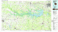
1986 Map of Texarkana
USGS Topo · Published 1986About this map
Wright Patman Lake and the winding Sulphur River dominate the central landscape of this tri-state border region during the mid-1980s. The sprawling industrial footprints of the Lone Star Army Ammunition Plant and the Red River Army Depot stand as significant landmarks west of Texarkana, illustrating the area's mid-century military and economic importance. To the south, the Cusseta Mountains provide a distinct topographic contrast to the river bottomlands, while smaller settlements like Atlanta, Queen City, and New Boston anchor the regional road and rail networks.
Find a feature on this map
163 named features on this map. Tap any name to fly to it.
Don’t see what you’re looking for? This feature index may not catch every label — zoom into the map to look around manually.
Map Details
Editions of this 1986 Texarkana Map
This is the sole edition of this map. No revisions or reprints were ever made.
Other maps of this area

1907 · Atlanta
USGS Topo · 1:62,500

1909 · New Boston
USGS Topo · 1:62,500

1909 · Texarkana
USGS Topo · 1:62,500

1910 · Linden
USGS Topo · 1:62,500

1910 · Atlanta
USGS Topo · 1:62,500

1914 · Daingerfield
USGS Topo · 1:62,500

1930 · Bassett
USGS Topo · 1:62,500

1932 · Hosston NW
USGS Topo · 1:31,680

1944 · Kildare
USGS Topo · 1:62,500

1948 · Kildare
USGS Topo · 1:62,500