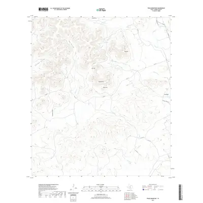
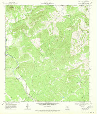
2019 Map of Texas Mountain
USGS Topo · Published 2019About this map
Texas Hill Country limestone peaks and deeply carved drainage basins define this portion of Medina County. High points such as Texas Mtn and Saathoff Mtn tower over a complex network of seasonal creeks and springs that feed into the larger Edwards Aquifer recharge zone. The drainage pattern is particularly evident through named corridors like Ney Hollow, Through Hollow, and the ominously titled Deadman Hollow. Water security in this arid landscape is marked by specific reliable sources such as Blue Waterhole and Mustang Waterhole, alongside perennial sources like Yellow Spring and Twin Springs. The map illustrates a rural landscape where movement is dictated by the terrain, with roads like Co RD 211 winding between summits and along creek beds such as Bear Spring Cr and Springs Cr. The presence of Eagle Bluff further emphasizes the verticality of the local geography.
Find a feature on this map
31 named features on this map. Tap any name to fly to it.
Don’t see what you’re looking for? This feature index may not catch every label — zoom into the map to look around manually.
Map Details
Editions of this 2019 Texas Mountain Map
This is the sole edition of this map. No revisions or reprints were ever made.
Other maps of this area

1954 · San Antonio
USGS Topo · 1:250,000

1956 · Sabinal
USGS Topo · 1:62,500

1956 · New Fountain
USGS Topo · 1:62,500

1956 · Tarpley
USGS Topo · 1:62,500

1956 · Bandera
USGS Topo · 1:62,500

1957 · San Antonio
USGS Topo · 1:250,000
1964 · Tarpley
USGS Topo · 1:24,000
1964 · Tarpley Pass
USGS Topo · 1:24,000
1964 · Seco Pass
USGS Topo · 1:24,000
1969 · Twin Hollow
USGS Topo · 1:24,000