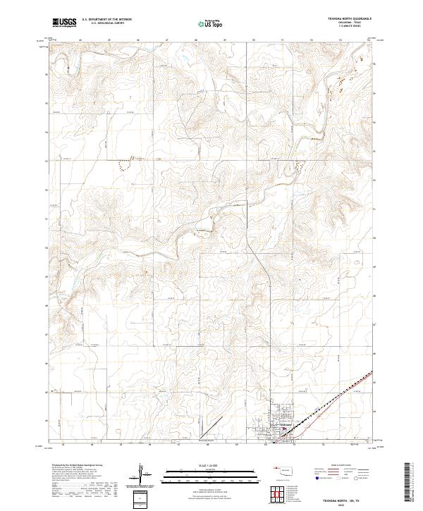
2022 Map of Texhoma North
USGS Topo · Published 2022About this map
The border community of Texhoma sits at the southern edge of this modern survey, where its street grid extends from Main St and Elm St toward the Municipal Airport. The landscape north of the settlement is defined by the winding course of the Beaver River, which carves a distinct path through the plains alongside smaller tributaries like Sand Creek and Sand Cr. This high plains terrain is partitioned into a geometric grid of rural routes, including Co Hwy 51 and Co Hwy 53, which connect scattered agricultural lands across township lines. The mapping of Illinois St and North St reveals the localized development of the town center near the state line, providing a precise look at the intersection of municipal infrastructure and the open river valley geography.
Find a feature on this map
49 named features on this map. Tap any name to fly to it.
Don’t see what you’re looking for? This feature index may not catch every label — zoom into the map to look around manually.
Map Details
Editions of this 2022 Texhoma North Map
This is the sole edition of this map. No revisions or reprints were ever made.
Other maps of this area

1954 · Perryton
USGS Topo · 1:250,000

1958 · Perryton
USGS Topo · 1:250,000

1965 · Stevens
USGS Topo · 1:24,000

1973 · Texhoma NE
USGS Topo · 1:24,000

1973 · Texhoma North
USGS Topo · 1:24,000

1973 · Goodwell NW
USGS Topo · 1:24,000
1973 · Texhoma SW
USGS Topo · 1:24,000
1973 · Texhoma NW
USGS Topo · 1:24,000

1973 · Goodwell
USGS Topo · 1:24,000

1974 · Sunray 1 NW
USGS Topo · 1:24,000