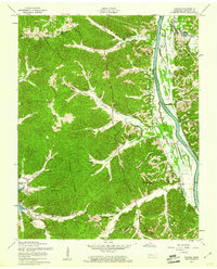
1957 Map of Tharpe
USGS Topo · Published 1960About this map
Tharpe stands at the center of this Tennessee landscape during a period of massive hydraulic engineering. The Cumberland River still flows within its natural banks, but the presence of Lake Barkley (Dam Under Construction) signals the coming transformation of the valley. To the west, Kentucky Lake is already established, its boundary marked by the Kentucky Lake Res Bdy. This map is a significant resource for genealogists, as it documents dozens of small family burial grounds and community landmarks before the landscape was further altered by reservoir flooding.
Find a feature on this map
54 named features on this map. Tap any name to fly to it.
Don’t see what you’re looking for? This feature index may not catch every label — zoom into the map to look around manually.
Map Details
Editions of this 1957 Tharpe Map
2 editions found
Other maps of this area

1936 · Tharpe
USGS Topo · 1:24,000

1936 · Hamlin
USGS Topo · 1:24,000

1936 · Centerville Landing
USGS Topo · 1:24,000

1936 · Rushing
USGS Topo · 1:24,000

1936 · Standing Rock
USGS Topo · 1:24,000

1936 · Dover
USGS Topo · 1:24,000

1950 · Rushing Creek
USGS Topo · 1:24,000
1950 · Paris Landing
USGS Topo · 1:24,000

1950 · Standing Rock
USGS Topo · 1:24,000
1950 · Hamlin
USGS Topo · 1:24,000