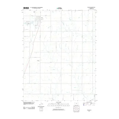
2010 Map of Thayer
USGS Topo · Published 2010About this map
Thayer anchors the landscape of this southeastern Kansas survey, situated at the confluence of several rural transportation routes. The community's infrastructure is centered around local water sources and landmarks, most notably the Thayer City Lake and the associated Thayer City Dam. The surrounding Neosho County countryside is defined by an extensive grid of section roads, including Neosho St and Douglas Rd, which navigate a drainage system formed by Elk River, Big Hill Creek, and Labette Creek. For those tracing local heritage, the map identifies significant burial sites like Thayer Cemetery and the more isolated South Center Cemetery. The grid layout of the township contrasts with the wandering paths of Little Labette Creek, illustrating the intersection of planned settlement and the natural geography of the plains.
Find a feature on this map
33 named features on this map. Tap any name to fly to it.
Don’t see what you’re looking for? This feature index may not catch every label — zoom into the map to look around manually.
Map Details
Editions of this 2010 Thayer Map
This is the sole edition of this map. No revisions or reprints were ever made.
Other maps of this area

1886 · Fredonia
USGS Topo · 1:125,000

1886 · Iola
USGS Topo · 1:125,000

1886 · Independence
USGS Topo · 1:125,000

1886 · Parsons
USGS Topo · 1:125,000

1893 · Iola
USGS Topo · 1:125,000

1893 · Parsons
USGS Topo · 1:125,000

1894 · Fredonia
USGS Topo · 1:125,000

1894 · Independence
USGS Topo · 1:125,000

1904 · Iola
USGS Topo · 1:125,000

1905 · Independence
USGS Topo · 1:125,000