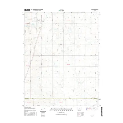
2015 Map of Thayer
USGS Topo · Published 2015About this map
Thayer serves as the central hub for this portion of Southeast Kansas, where the grid of the Public Land Survey System meets the natural drainages of the Cherokee Lowlands. The town's layout is defined by its residential streets, including Watermelon St and Neosho St, situated just east of Thayer City Lake. This landscape is primarily agricultural, with section roads like 80th Rd and 50th Rd crossing a network of prairie streams including Big Hill Cr and Labette Cr.
Find a feature on this map
38 named features on this map. Tap any name to fly to it.
Don’t see what you’re looking for? This feature index may not catch every label — zoom into the map to look around manually.
Map Details
Editions of this 2015 Thayer Map
This is the sole edition of this map. No revisions or reprints were ever made.
Other maps of this area

1886 · Fredonia
USGS Topo · 1:125,000

1886 · Iola
USGS Topo · 1:125,000

1886 · Independence
USGS Topo · 1:125,000

1886 · Parsons
USGS Topo · 1:125,000

1893 · Iola
USGS Topo · 1:125,000

1893 · Parsons
USGS Topo · 1:125,000

1894 · Fredonia
USGS Topo · 1:125,000

1894 · Independence
USGS Topo · 1:125,000

1904 · Iola
USGS Topo · 1:125,000

1905 · Independence
USGS Topo · 1:125,000