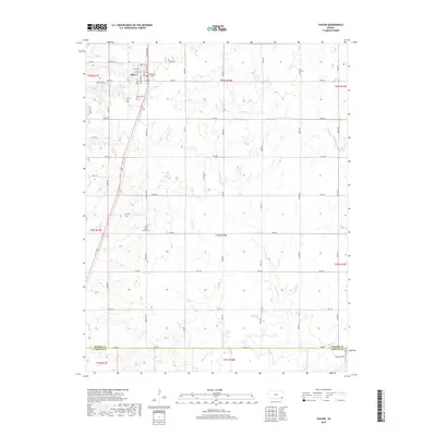
2018 Map of Thayer
USGS Topo · Published 2018About this map
Thayer anchors the northwestern corner of this Kansas landscape, where a grid of rural roads connects the surrounding prairie. The town site is defined by a dense cluster of streets, including Wilson St, Labette St, and Osage St, situated just west of the Thayer Cem. The terrain is shaped by the complex drainage systems of Elk River and several major tributaries such as Labette Cr and Big Hill Cr, which create subtle variations in the topography of Neosho and Labette Counties. Genealogists and local researchers can trace the rural layout down to South Center Cem and the small airfield at Pearce Field near the southern boundary. This 2018 survey provides a precise modern view of the townships before any further shifts in land use or infrastructure occur in this agricultural region.
Find a feature on this map
52 named features on this map. Tap any name to fly to it.
Don’t see what you’re looking for? This feature index may not catch every label — zoom into the map to look around manually.
Map Details
Editions of this 2018 Thayer Map
This is the sole edition of this map. No revisions or reprints were ever made.
Other maps of this area

1886 · Fredonia
USGS Topo · 1:125,000

1886 · Iola
USGS Topo · 1:125,000

1886 · Independence
USGS Topo · 1:125,000

1886 · Parsons
USGS Topo · 1:125,000

1893 · Iola
USGS Topo · 1:125,000

1893 · Parsons
USGS Topo · 1:125,000

1894 · Fredonia
USGS Topo · 1:125,000

1894 · Independence
USGS Topo · 1:125,000

1904 · Iola
USGS Topo · 1:125,000

1905 · Independence
USGS Topo · 1:125,000