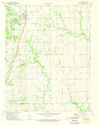
1973 Map of Thayer
USGS Topo · Published 1975About this map
The town of Thayer serves as the central hub of this Neosho County landscape in the early 1970s, positioned along the Atchison Topeka and Santa Fe railroad line. The settlement pattern reflects a stable agricultural community punctuated by resource extraction, evidenced by a significant Oil Field spanning the western sections and a Gravel Pit to the east. Local history and genealogy are well-represented by the Thayer Cem and South Center Cem, while the Otterbein Ch stands in the southeast corner near the Labette County border. The terrain is defined by the drainage networks of Big Hill Creek, Labette Creek, and Little Labette Creek, which carve through the townships of Chetopa and Shiloh. Near the town center, City Lake provides a localized water feature amidst the rural grid of the Osage and Centerville areas.
Find a feature on this map
19 named features on this map. Tap any name to fly to it.
Don’t see what you’re looking for? This feature index may not catch every label — zoom into the map to look around manually.
Map Details
Editions of this 1973 Thayer Map
This is the sole edition of this map. No revisions or reprints were ever made.
Other maps of this area

1886 · Fredonia
USGS Topo · 1:125,000

1886 · Iola
USGS Topo · 1:125,000

1886 · Independence
USGS Topo · 1:125,000

1886 · Parsons
USGS Topo · 1:125,000

1893 · Iola
USGS Topo · 1:125,000

1893 · Parsons
USGS Topo · 1:125,000

1894 · Fredonia
USGS Topo · 1:125,000

1894 · Independence
USGS Topo · 1:125,000

1904 · Iola
USGS Topo · 1:125,000

1905 · Independence
USGS Topo · 1:125,000