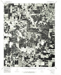
1976 Map of Thayer NW
USGS Topo · Published 1977About this map
Brandsville is the primary focal point of this orthophotoquad, which captures the rural landscape of Howell County as it appeared in the mid-1970s. The imagery reveals a stark contrast between the dense wooded hills and the geometric patchwork of cleared agricultural land. A major transportation corridor bisects the terrain, passing directly through the heart of the settlement and serving as a lifeline for the local farming and ranching economy. This aerial perspective, derived from high-altitude photography, provides a rare look at the precise layout of homesteads, farm roads, and woodlots before more modern development patterns altered the rural Missouri interior.
Find a feature on this map
1 named feature on this map. Tap any name to fly to it.
Don’t see what you’re looking for? This feature index may not catch every label — zoom into the map to look around manually.
Map Details
Editions of this 1976 Thayer NW Map
This is the sole edition of this map. No revisions or reprints were ever made.
Other maps of this area

1938 · West Plains
USGS Topo · 1:24,000

1940 · West Plains
USGS Topo · 1:24,000

1943 · Thayer
USGS Topo · 1:62,500

1944 · West Plains
USGS Topo · 1:62,500

1945 · Willow Springs
USGS Topo · 1:62,500

1945 · Montier
USGS Topo · 1:62,500

1946 · Thayer
USGS Topo · 1:62,500

1946 · West Plains
USGS Topo · 1:62,500

1948 · Montier
USGS Topo · 1:62,500

1948 · Willow Springs
USGS Topo · 1:62,500