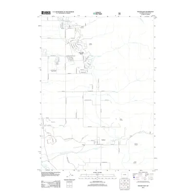
2012 Map of Thayne East
USGS Topo · Published 2012About this map
Star Valley Ranch serves as a primary residential focal point in this 2012 survey, characterized by an intricate network of winding mountain roads and local aviation facilities like the Star Valley Ranch Airport and Lone Pine Flying Ranch Airport. The landscape transition from the developed ranch area to the more traditional rural layout of Bedford illustrates the diversifying land use in Lincoln County. Waterways such as Strawberry Cr and Flat Cr drain the eastern canyons, including Prater Canyon and Herman Canyon, which define the rugged topographical backdrop. Genealogists and local historians can locate established burial grounds such as Thayne Cem and Bedford Cem, situated near the agricultural flats. The map also records numerous local thoroughfares like Muddy String Rd and Cedar Creek Rd, providing a clear view of the area's connectivity during the early 21st century.
Find a feature on this map
86 named features on this map. Tap any name to fly to it.
Don’t see what you’re looking for? This feature index may not catch every label — zoom into the map to look around manually.
Map Details
Editions of this 2012 Thayne East Map
This is the sole edition of this map. No revisions or reprints were ever made.
Other maps of this area

1915 · Freedom
USGS Topo · 1:62,500

1921 · Afton
USGS Topo · 1:125,000

1931 · Jackson
USGS Topo · 1:125,000

1932 · Irwin
USGS Topo · 1:96,000

1935 · Irwin
USGS Topo · 1:125,000

1935 · Jackson
USGS Topo · 1:125,000

1955 · Driggs
USGS Topo · 1:250,000

1955 · Preston
USGS Topo · 1:250,000

1958 · Driggs
USGS Topo · 1:250,000

1958 · Preston
USGS Topo · 1:250,000