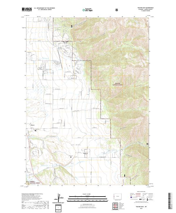
2021 Map of Thayne East
USGS Topo · Published 2021About this map
Star Valley's eastern reaches are defined by a striking transition from the developed valley floor to the soaring heights of the Bridger National Forest. The residential layout of Star Valley Ranch climbs the western foothills, punctuated by the Star Valley Ranch Airport and a dense network of suburban drives like Vista Dr and Hillside Way. This modern community contrasts with the more traditional agricultural and civic patterns found near Thayne and Bedford. Waterways such as Strawberry Cr and N Br Cedar Cr flow westward from the high canyons, including Prater Canyon and Green Canyon. The presence of the Thayne Cem and Bedford Cem provides essential touchpoints for genealogical research in Lincoln County, while the Cokeville Meadows National Wildlife Refuge protects the wetlands along the valley's western edge.
Find a feature on this map
100 named features on this map. Tap any name to fly to it.
Don’t see what you’re looking for? This feature index may not catch every label — zoom into the map to look around manually.
Map Details
Editions of this 2021 Thayne East Map
This is the sole edition of this map. No revisions or reprints were ever made.
Other maps of this area

1915 · Freedom
USGS Topo · 1:62,500

1921 · Afton
USGS Topo · 1:125,000

1931 · Jackson
USGS Topo · 1:125,000

1932 · Irwin
USGS Topo · 1:96,000

1935 · Irwin
USGS Topo · 1:125,000

1935 · Jackson
USGS Topo · 1:125,000

1955 · Driggs
USGS Topo · 1:250,000

1955 · Preston
USGS Topo · 1:250,000

1958 · Driggs
USGS Topo · 1:250,000

1958 · Preston
USGS Topo · 1:250,000