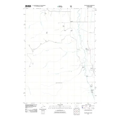
2011 Map of Thayne West
USGS Topo · Published 2011About this map
The Salt River valley defines this borderlands topography where Wyoming meets Idaho. The settlement of Freedom sits directly on the state line, while Thayne anchors the eastern edge of the quadrangle along the valley floor. The landscape is a transition from the agricultural flats near Flat Creek to the deep incisions of Log Canyon and Weber Canyon in the west. Genealogists will find the Freedom Cemetery positioned near Haderlie Knoll, overlooking the river's meandering course. The map details a complex drainage system feeding the valley, including Tincup Creek and Miller Creek, which carve through the high ground of Old Man Ridge. Access into the Caribou NF Rd 156 reveals the more isolated terrain of the western canyons, where names like Swab Creek and Limekiln Creek suggest the early ranching and resource-use patterns of the Star Valley region.
Find a feature on this map
40 named features on this map. Tap any name to fly to it.
Don’t see what you’re looking for? This feature index may not catch every label — zoom into the map to look around manually.
Map Details
Editions of this 2011 Thayne West Map
This is the sole edition of this map. No revisions or reprints were ever made.
Other maps of this area

1915 · Freedom
USGS Topo · 1:62,500

1921 · Afton
USGS Topo · 1:125,000

1931 · Jackson
USGS Topo · 1:125,000

1932 · Irwin
USGS Topo · 1:96,000

1935 · Irwin
USGS Topo · 1:125,000

1935 · Jackson
USGS Topo · 1:125,000

1955 · Driggs
USGS Topo · 1:250,000

1955 · Preston
USGS Topo · 1:250,000

1958 · Driggs
USGS Topo · 1:250,000

1958 · Preston
USGS Topo · 1:250,000