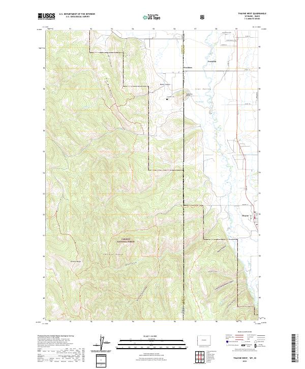
2021 Map of Thayne West
USGS Topo · Published 2021About this map
State Line Rd marks a distinct geographical boundary in this 2021 survey, bisecting the settlement of Freedom, which straddles the border of Idaho and Wyoming. Situated in the upper Star Valley, this area shows a transition from the agricultural lowlands near The Slough to the prominent rising terrain of the Caribou Range. To the west, the Caribou National Forest dominates the landscape, characterized by a series of steep drainages including Log Canyon, Smith Canyon, and Beard Canyon. Local landmarks such as Haderlie Knoll and the Freedom Cem provide focal points for genealogical research within this rural community. The eastern edge of the map includes a portion of Thayne, connected to the surrounding countryside by a network of local roads including Roberts St and Bridger Dr. The survey clearly delineates the complex topography of Old Man Ridge and the various forks of the mountain canyons.
Find a feature on this map
41 named features on this map. Tap any name to fly to it.
Don’t see what you’re looking for? This feature index may not catch every label — zoom into the map to look around manually.
Map Details
Editions of this 2021 Thayne West Map
This is the sole edition of this map. No revisions or reprints were ever made.
Other maps of this area

1915 · Freedom
USGS Topo · 1:62,500

1921 · Afton
USGS Topo · 1:125,000

1931 · Jackson
USGS Topo · 1:125,000

1932 · Irwin
USGS Topo · 1:96,000

1935 · Irwin
USGS Topo · 1:125,000

1935 · Jackson
USGS Topo · 1:125,000

1955 · Driggs
USGS Topo · 1:250,000

1955 · Preston
USGS Topo · 1:250,000

1958 · Driggs
USGS Topo · 1:250,000

1958 · Preston
USGS Topo · 1:250,000