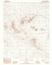
1986 Map of The Buttes
USGS Topo · Published 1986About this map
The Buttes dominate the center of this high desert terrain in San Bernardino County, where the stark topography of the Mojave is meticulously recorded. Mapping efforts by the Geological Survey in the mid-1980s emphasize the geological and extractive character of this arid landscape, highlighting numerous Prospects and individual Prospect sites scattered across the hillsides and ridge lines. These markers indicate a history of mineral exploration and small-scale mining operations that defined the local economy and land use during this era. Low-lying areas are characterized by several Dry Lake beds, which serve as natural drainage basins for the surrounding elevations. The map provides a precise look at the township and range survey lines, including the intersections of T 32 S T 12 N and R 42 E R 43 E, which are essential for property research and historical land tracking.
Find a feature on this map
8 named features on this map. Tap any name to fly to it.
Don’t see what you’re looking for? This feature index may not catch every label — zoom into the map to look around manually.
Map Details
Editions of this 1986 The Buttes Map
This is the sole edition of this map. No revisions or reprints were ever made.
Other maps of this area

1915 · Searles Lake
USGS Topo · 1:250,000

1932 · Barstow
USGS Topo · 1:125,000

1934 · Barstow
USGS Topo · 1:125,000

1937 · Kramer
USGS Topo · 1:48,000

1942 · Kramer
USGS Topo · 1:62,500

1947 · Kramer
USGS Topo · 1:24,000

1947 · Johannesburg SE
USGS Topo · 1:25,000

1947 · Trona
USGS Topo · 1:250,000

1948 · Trona
USGS Topo · 1:250,000

1953 · San Bernardino
USGS Topo · 1:250,000