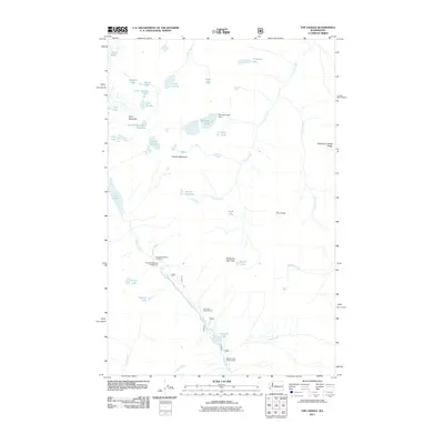
2011 Map of The Cradle
USGS Topo · Published 2011About this map
The Cradle towers over a high-altitude wilderness where glacial activity has carved a landscape of scattered alpine tarns and steep granite divides. This 2011 survey captures the headwaters of the Cle Elum River, tracing its descent through Tucquala Lake and past established recreational sites like Fish Lake Campground. The presence of the Klonaqua Lake Dam at the Klonaqua Lakes reveals early water management efforts deep within the backcountry, while named features such as Paddy-Go-Easy Pass and Sixtysix Hundred Ridge highlight the complex topography used by hikers and packers. From the Granite Mountain Potholes to the clusters of small lakes like Robin Lakes and Jungfrau Lake, the map documents a region defined by its hydrography and high-elevation landforms.
Find a feature on this map
40 named features on this map. Tap any name to fly to it.
Don’t see what you’re looking for? This feature index may not catch every label — zoom into the map to look around manually.
Map Details
Editions of this 2011 The Cradle Map
This is the sole edition of this map. No revisions or reprints were ever made.
Other maps of this area

1897 · Mount Stuart
USGS Topo · 1:125,000

1901 · Chiwaukum
USGS Topo · 1:125,000

1901 · Snoqualmie Pass
USGS Topo · 1:125,000

1902 · Skykomish
USGS Topo · 1:125,000

1902 · Mount Stuart
USGS Topo · 1:125,000

1903 · Snoqualmie
USGS Topo · 1:125,000

1904 · Chiwaukum
USGS Topo · 1:125,000

1905 · Skykomish
USGS Topo · 1:125,000

1957 · Wenatchee
USGS Topo · 1:250,000

1961 · Mount Stuart
USGS Topo · 1:62,500