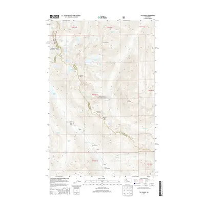
2014 Map of The Cradle
USGS Topo · Published 2014About this map
The Cradle stands as a prominent peak within the complex geography of the Wenatchee National Forest, where the high alpine terrain of the Wenatchee Mountains meets the headwaters of the Cle Elum River. This survey captures the intricate network of water bodies and ridgelines at the intersection of King, Chelan, and Kittitas counties. High-altitude basins are dotted with numerous small lakes, including Robin Lakes, Klonaqua Lakes, and the uniquely named Turquoise Lake and Sprite Lake. The map details the transition from the river valley, home to the Tucquala Meadow Campground, up through the steep elevations of Paddy-Go-Easy Pass and French Ridge. These landmarks trace the historical routes through the Cascades, providing a clear record of the recreational infrastructure and natural hydrology of the central Washington high country during the early twenty-first century.
Find a feature on this map
54 named features on this map. Tap any name to fly to it.
Don’t see what you’re looking for? This feature index may not catch every label — zoom into the map to look around manually.
Map Details
Editions of this 2014 The Cradle Map
This is the sole edition of this map. No revisions or reprints were ever made.
Other maps of this area

1897 · Mount Stuart
USGS Topo · 1:125,000

1901 · Chiwaukum
USGS Topo · 1:125,000

1901 · Snoqualmie Pass
USGS Topo · 1:125,000

1902 · Skykomish
USGS Topo · 1:125,000

1902 · Mount Stuart
USGS Topo · 1:125,000

1903 · Snoqualmie
USGS Topo · 1:125,000

1904 · Chiwaukum
USGS Topo · 1:125,000

1905 · Skykomish
USGS Topo · 1:125,000

1957 · Wenatchee
USGS Topo · 1:250,000

1961 · Mount Stuart
USGS Topo · 1:62,500