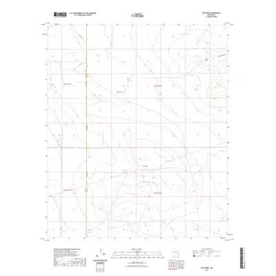
2023 Map of The Divide
USGS Topo · Published 2023About this map
The high desert terrain of the Eddy and Lea County line is defined by a series of isolated water catchments and topographic elevations. The Divide runs through the southern half of the sheet, providing a natural rise above the surrounding flats. To the north, the prominent Hat Mesa and the depression of Bilbrey Basin characterize the landscape. The region relies on a network of named tanks, including Rockbottom Tank, Lost Tank, and Under the Hill Tank, which are essential for livestock and local management in this arid stretch of New Mexico. Modern infrastructure is limited to through-ways like Campbell Rd and Delaware Basin Rd, reflecting the sparse, utilitarian nature of the high plains bordering the Permian Basin.
Find a feature on this map
15 named features on this map. Tap any name to fly to it.
Don’t see what you’re looking for? This feature index may not catch every label — zoom into the map to look around manually.
Map Details
Editions of this 2023 The Divide Map
This is the sole edition of this map. No revisions or reprints were ever made.
Other maps of this area

1939 · Nash Draw
USGS Topo · 1:62,500

1942 · Clayton Basin
USGS Topo · 1:62,500

1943 · Clayton Basin
USGS Topo · 1:62,500

1943 · Nash Draw
USGS Topo · 1:62,500

1954 · Hobbs
USGS Topo · 1:250,000

1958 · Hobbs
USGS Topo · 1:250,000

1963 · Laguna Gatuna
USGS Topo · 1:62,500

1963 · Hat Mesa
USGS Topo · 1:62,500

1978 · Jal
USGS Topo · 1:100,000

1984 · Lea
USGS Topo · 1:24,000