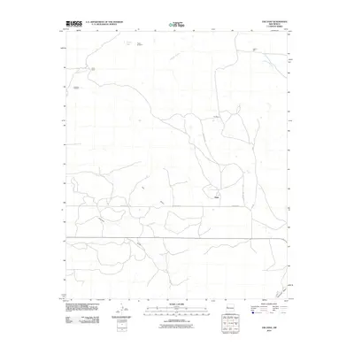
2010 Map of The Dyke
USGS Topo · Published 2010About this map
Tingle and White Ranch sit within a high-desert landscape defined by complex drainage systems and the striking topographic prominence of The Dyke. This 2010 survey illustrates a pastoral economy dependent on scattered water sources, marked by family-named landmarks like Hogan Windmill, Gonzales Windmill, and Paz Well. The orientation of the local road network, including Old County Rd and County Rd 35, follows the natural contours of the land, navigating around the seasonal watercourses of Lorenzo Arroyo and Jaralosa Draw.
Find a feature on this map
16 named features on this map. Tap any name to fly to it.
Don’t see what you’re looking for? This feature index may not catch every label — zoom into the map to look around manually.
Map Details
Editions of this 2010 The Dyke Map
This is the sole edition of this map. No revisions or reprints were ever made.
Other maps of this area

1954 · Saint Johns
USGS Topo · 1:250,000

1957 · Saint Johns
USGS Topo · 1:250,000

1958 · Saint Johns
USGS Topo · 1:250,000

1962 · Saint Johns
USGS Topo · 1:250,000

1967 · Red Lake Mission
USGS Topo · 1:24,000

1967 · Chimney Hill
USGS Topo · 1:24,000
1967 · Techado
USGS Topo · 1:24,000

1972 · Fence Lake
USGS Topo · 1:24,000
1972 · Cerro Prieto
USGS Topo · 1:24,000

1972 · Fence Lake SW
USGS Topo · 1:24,000