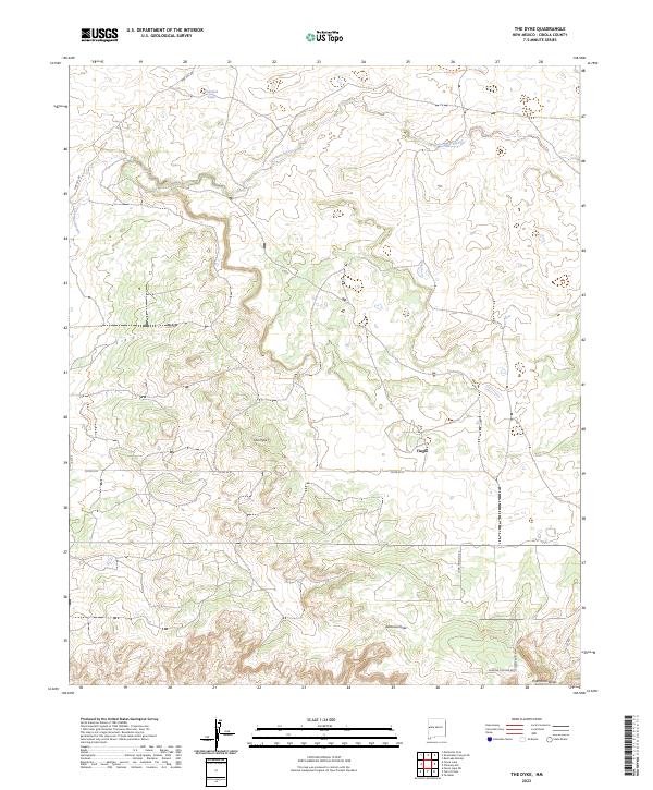
2023 Map of The Dyke
USGS Topo · Published 2023About this map
The settlement of Tingle stands amidst the complex terrain of Cibola County, where the prominent geologic formation known as The Dyke cuts across the landscape. This high-desert region is defined by its drainage systems, including the westward-flowing Lorenzo Arroyo and the southern Jaralosa Draw, which eventually meet Puertocito Draw at the map's edge. To the north, Jaramie Lake provides a rare water feature in this arid environment near Pine Hill Rd. The map illustrates a contemporary rural network where traditional boundaries like t5n r17w intersect with more modern residential naming conventions seen in Meadow View Ln and Shadow Canyon Rd. The convergence of Co Rd 35 D and Long Horizon Rd suggests the continued importance of these corridors for local access within the township and range system.
Find a feature on this map
16 named features on this map. Tap any name to fly to it.
Don’t see what you’re looking for? This feature index may not catch every label — zoom into the map to look around manually.
Map Details
Editions of this 2023 The Dyke Map
This is the sole edition of this map. No revisions or reprints were ever made.
Other maps of this area

1954 · Saint Johns
USGS Topo · 1:250,000

1957 · Saint Johns
USGS Topo · 1:250,000

1958 · Saint Johns
USGS Topo · 1:250,000

1962 · Saint Johns
USGS Topo · 1:250,000

1967 · Red Lake Mission
USGS Topo · 1:24,000

1967 · Chimney Hill
USGS Topo · 1:24,000
1967 · Techado
USGS Topo · 1:24,000

1972 · Fence Lake
USGS Topo · 1:24,000
1972 · Cerro Prieto
USGS Topo · 1:24,000

1972 · Fence Lake SW
USGS Topo · 1:24,000