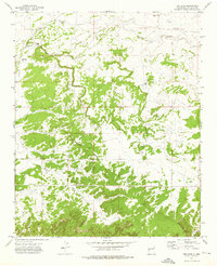
1972 Map of The Dyke
USGS Topo · Published 1976About this map
Lorenzo and the surrounding ranchlands of Valencia County define this 1970s landscape, a region where water management dictated the footprint of human activity. The map reveals a network of vital water sources necessary for livestock and settlement in the high desert, including Hogan Windmill, Juanito Well, and Paz Well. These features, along with the Gonzales Windmill, trace the development of local ranching operations like the White Ranch during an era when self-sustaining water infrastructure was paramount.
Find a feature on this map
17 named features on this map. Tap any name to fly to it.
Don’t see what you’re looking for? This feature index may not catch every label — zoom into the map to look around manually.
Map Details
Editions of this 1972 The Dyke Map
This is the sole edition of this map. No revisions or reprints were ever made.
Other maps of this area

1954 · Saint Johns
USGS Topo · 1:250,000

1957 · Saint Johns
USGS Topo · 1:250,000

1958 · Saint Johns
USGS Topo · 1:250,000

1962 · Saint Johns
USGS Topo · 1:250,000

1967 · Red Lake Mission
USGS Topo · 1:24,000

1967 · Chimney Hill
USGS Topo · 1:24,000
1967 · Techado
USGS Topo · 1:24,000

1972 · Fence Lake
USGS Topo · 1:24,000
1972 · Cerro Prieto
USGS Topo · 1:24,000

1972 · Fence Lake SW
USGS Topo · 1:24,000