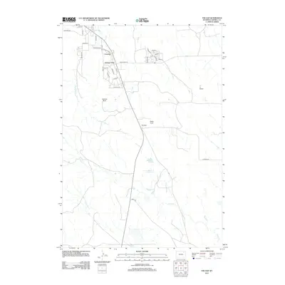
2012 Map of The Gap
USGS Topo · Published 2012About this map
Crestview and Antelope Valley anchor the northern reaches of this Wyoming landscape, showing the suburban expansion south of Gillette in the early 21st century. The terrain is defined by its drainage systems and high points, including the prominent Antelope Butte and Rocky Butte. The road network connects residential developments like Sleepy Hollow Blvd to the open rangeland, where agricultural water management is evident at Rourke Reservoir and Rourke Number 1 Reservoir.
Find a feature on this map
36 named features on this map. Tap any name to fly to it.
Don’t see what you’re looking for? This feature index may not catch every label — zoom into the map to look around manually.
Map Details
Editions of this 2012 The Gap Map
This is the sole edition of this map. No revisions or reprints were ever made.
Other maps of this area

1954 · Gillette
USGS Topo · 1:250,000

1955 · Gillette
USGS Topo · 1:250,000

1958 · Gillette
USGS Topo · 1:250,000

1962 · Gillette
USGS Topo · 1:250,000

1971 · Scaper Reservoir
USGS Topo · 1:24,000

1971 · Coyote Draw
USGS Topo · 1:24,000

1971 · The Gap SW
USGS Topo · 1:24,000

1971 · Gillette East
USGS Topo · 1:24,000
1971 · Saddle Horse Butte
USGS Topo · 1:24,000
1971 · The Gap
USGS Topo · 1:24,000