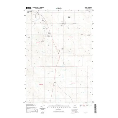
2015 Map of The Gap
USGS Topo · Published 2015About this map
Gillette and its southern residential expansions define the landscape of this 2015 survey, where suburban development meets the high plains of Campbell County. The settlements of Crestview and Antelope Valley are prominently featured, showing a network of residential streets such as Gallery View Dr and Ptarmigan Ave that push into the surrounding terrain. Further east, Sleepy Hollow sits as a distinct residential pocket, separated from the main urban corridor by rolling open spaces.
Find a feature on this map
46 named features on this map. Tap any name to fly to it.
Don’t see what you’re looking for? This feature index may not catch every label — zoom into the map to look around manually.
Map Details
Editions of this 2015 The Gap Map
This is the sole edition of this map. No revisions or reprints were ever made.
Other maps of this area

1954 · Gillette
USGS Topo · 1:250,000

1955 · Gillette
USGS Topo · 1:250,000

1958 · Gillette
USGS Topo · 1:250,000

1962 · Gillette
USGS Topo · 1:250,000

1971 · Scaper Reservoir
USGS Topo · 1:24,000

1971 · Coyote Draw
USGS Topo · 1:24,000

1971 · The Gap SW
USGS Topo · 1:24,000

1971 · Gillette East
USGS Topo · 1:24,000
1971 · Saddle Horse Butte
USGS Topo · 1:24,000
1971 · The Gap
USGS Topo · 1:24,000