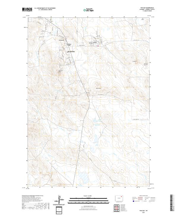
2021 Map of The Gap
USGS Topo · Published 2021About this map
Residential growth extending from the southern edge of Gillette defines the landscape of this Campbell County quadrangle. Suburban developments like Crestview, Antelope Valley, and Sleepy Hollow sit tucked between the open draws and buttes of the Wyoming plains, showing the intersection of ranching country and modern town expansion. The map captures a detailed street network, from Union Chapel Rd to localized residential circles, illustrating how these communities have matured within the township boundaries of T49N and T48N.
Find a feature on this map
49 named features on this map. Tap any name to fly to it.
Don’t see what you’re looking for? This feature index may not catch every label — zoom into the map to look around manually.
Map Details
Editions of this 2021 The Gap Map
This is the sole edition of this map. No revisions or reprints were ever made.
Other maps of this area

1954 · Gillette
USGS Topo · 1:250,000

1955 · Gillette
USGS Topo · 1:250,000

1958 · Gillette
USGS Topo · 1:250,000

1962 · Gillette
USGS Topo · 1:250,000

1971 · Scaper Reservoir
USGS Topo · 1:24,000

1971 · Coyote Draw
USGS Topo · 1:24,000

1971 · The Gap SW
USGS Topo · 1:24,000

1971 · Gillette East
USGS Topo · 1:24,000
1971 · Saddle Horse Butte
USGS Topo · 1:24,000
1971 · The Gap
USGS Topo · 1:24,000