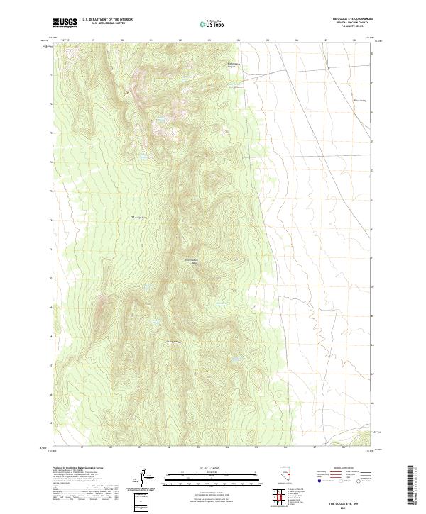
2021 Map of The Gouge Eye
USGS Topo · Published 2021About this map
The Gouge Eye occupies the central landscape of this Lincoln County survey, providing a detailed record of the water sources that sustained ranching and transit in this arid Nevada corridor. The terrain is dominated by the Fortification Range, where numerous critical watering points are documented, including Wild Horse Spring, Fortification Spring, and the namesake Gouge Eye Spring. These features reflect a legacy of livestock management and survival in the high desert, where named springs often marked the difference between success and failure for early travelers and homesteaders.
Find a feature on this map
19 named features on this map. Tap any name to fly to it.
Don’t see what you’re looking for? This feature index may not catch every label — zoom into the map to look around manually.
Map Details
Editions of this 2021 The Gouge Eye Map
This is the sole edition of this map. No revisions or reprints were ever made.
Other maps of this area

1956 · Lund
USGS Topo · 1:250,000

1960 · Lund
USGS Topo · 1:250,000

1973 · Gouge Eye Well
USGS Topo · 1:24,000

1973 · Horse Corral Pass
USGS Topo · 1:24,000

1973 · Atlanta
USGS Topo · 1:24,000

1973 · Indian Springs Knolls
USGS Topo · 1:24,000
1973 · Mustang Well
USGS Topo · 1:24,000
1973 · Mount Grafton NE
USGS Topo · 1:24,000

1973 · Red Ledges
USGS Topo · 1:24,000
1973 · Wells Summit
USGS Topo · 1:24,000