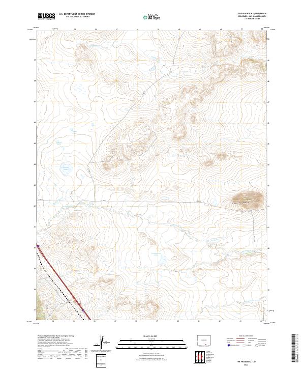
2022 Map of The Hogback
USGS Topo · Published 2022About this map
The Apishapa River winds through this section of Las Animas County, carving a path across a landscape defined by the prominent ridge of The Hogback. This modern topographical survey reveals an intricate network of water management, where the Saiz Ditch and Borrego Ditch divert resources across the high plains. Small, named bodies of water like Jones Lake, Gabriel Lake, and Dupont Lake are scattered through the northwestern township, while the larger Freeburrow Lake sits further south. The drainage patterns of Salado Cr and the Del Aqua Arroyo illustrate the rugged hydraulic character of the region. These features, along with rural routes such as Co RD 60 and Co RD 61, show how water and terrain have dictated the placement of livestock and ranching infrastructure in this part of Colorado.
Find a feature on this map
23 named features on this map. Tap any name to fly to it.
Don’t see what you’re looking for? This feature index may not catch every label — zoom into the map to look around manually.
Map Details
Editions of this 2022 The Hogback Map
This is the sole edition of this map. No revisions or reprints were ever made.
Other maps of this area

1891 · Walsenburg
USGS Topo · 1:125,000

1891 · Spanish Peaks
USGS Topo · 1:125,000

1891 · Apishapa
USGS Topo · 1:125,000

1892 · Elmoro
USGS Topo · 1:125,000

1893 · Spanish Peaks
USGS Topo · 1:125,000

1893 · Apishapa
USGS Topo · 1:125,000

1893 · Elmoro
USGS Topo · 1:125,000

1894 · Walsenburg
USGS Topo · 1:125,000

1895 · Spanish Peaks
USGS Topo · 1:125,000

1897 · Walsenburg
USGS Topo · 1:125,000