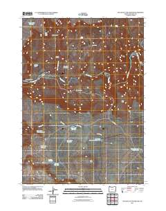
2011 Map of The Hole in the Ground
USGS Topo · Published 2011About this map
The Hole in the Ground defines this high-desert landscape in Malheur County, where the Owyhee River carves through deep volcanic canyons. The 2011 survey documents a remote ranching territory where water management is critical, as evidenced by a network of upland basins including Tuesday Reservoir, Wednesday Reservoir, and Lodge Reservoir Number One. Local land use is tied to long-standing family operations such as Morcom Ranch and Henry Ranch, connected by the unpaved corridor of Morcom Rd. Dramatic vertical relief is captured along Owyhee Canyon and Black Canyon, while naming conventions like Riley Horn Point and Deer Butte help orient navigation across the plateaus. Notable river features like Greeley Bar and the Rock Dam reflect the geological and human adaptations to this arid river system.
Find a feature on this map
29 named features on this map. Tap any name to fly to it.
Don’t see what you’re looking for? This feature index may not catch every label — zoom into the map to look around manually.
Map Details
Editions of this 2011 The Hole in the Ground Map
This is the sole edition of this map. No revisions or reprints were ever made.
Other maps of this area

1955 · Boise
USGS Topo · 1:250,000

1958 · Boise
USGS Topo · 1:250,000

1962 · Boise
USGS Topo · 1:250,000

1967 · Diamond Butte
USGS Topo · 1:24,000

1969 · Jordan Craters South
USGS Topo · 1:24,000

1969 · Jordan Craters North
USGS Topo · 1:24,000

1972 · Cedar Mountain
USGS Topo · 1:24,000
1972 · Lambert Rocks
USGS Topo · 1:24,000

1972 · Big Mud Flat
USGS Topo · 1:24,000
1972 · Rinehart Canyon
USGS Topo · 1:24,000