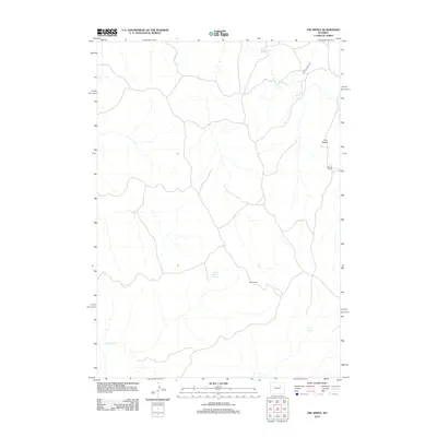
2012 Map of The Nipple
USGS Topo · Published 2012About this map
The Nipple rises above a landscape defined by ranching and vital water sources in this Campbell County region. Remote outposts like Dobrenz Ranch and Wilson Ranch are linked by a network of local roads and 4WD tracks, illustrating the sparse but enduring settlement patterns of northeastern Wyoming. Hydrology is central to life here, with the northern reaches drained by Pumpkin Cr while the southern portion features Willow Cr. Permanent water sources like School Section Spring and Craney Spring provide necessary points of interest for livestock and local wildlife. This 2012 survey by the U.S. Geological Survey documents the terrain and property boundaries that characterize this high plains environment during the early 21st century.
Find a feature on this map
7 named features on this map. Tap any name to fly to it.
Don’t see what you’re looking for? This feature index may not catch every label — zoom into the map to look around manually.
Map Details
Editions of this 2012 The Nipple Map
This is the sole edition of this map. No revisions or reprints were ever made.
Other maps of this area

1953 · Hoe Ranch
USGS Topo · 1:24,000

1953 · Fort Reno
USGS Topo · 1:24,000

1953 · Fort Reno SE
USGS Topo · 1:24,000

1953 · Fats Draw
USGS Topo · 1:24,000

1953 · The Nipple
USGS Topo · 1:24,000

1953 · North Butte
USGS Topo · 1:24,000

1954 · Gillette
USGS Topo · 1:250,000

1955 · Newcastle
USGS Topo · 1:250,000

1955 · Sheridan
USGS Topo · 1:250,000

1955 · Arminto
USGS Topo · 1:250,000