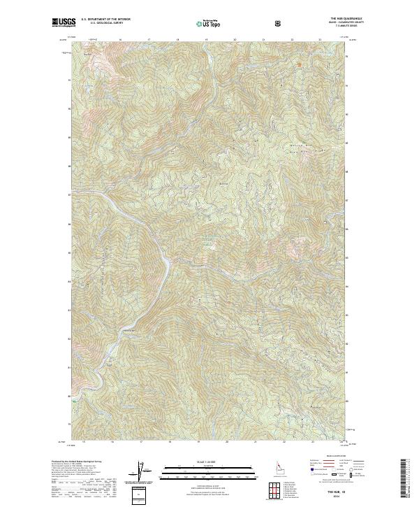
2024 Map of The Nub
USGS Topo · Published 2024About this map
Clearwater National Forest dominates this landscape, where the North Fork Clearwater River carves a deep path through the Sheep Mountain Range. The topography is defined by high ridgelines and isolated summits, including the prominent peak of The Nub and the expansive Indian Henry Ridge to the east. Transportation through this backcountry is limited to forest corridors like Co RD 247, which follows the river's bend near Moscow Bar. This 2024 survey captures a wilderness drainage network shaped by dozens of tributaries, from Skull Creek in the north to Pot Creek in the south, illustrating the complex hydrology of the Bitterroot foothills. Notable landmarks such as Bold Knob and Mush Point provide critical orientation points within this dense timberland, while Nub Lakes sit high in the northern alpine terrain.
Find a feature on this map
52 named features on this map. Tap any name to fly to it.
Don’t see what you’re looking for? This feature index may not catch every label — zoom into the map to look around manually.
Map Details
Editions of this 2024 The Nub Map
This is the sole edition of this map. No revisions or reprints were ever made.
Other maps of this area

1911 · Lolo
USGS Topo · 1:250,000

1913 · Lolo
USGS Topo · 1:250,000

1923 · Washington Creek
USGS Topo · 1:125,000

1956 · Hamilton
USGS Topo · 1:250,000

1959 · Hamilton
USGS Topo · 1:250,000

1960 · Hamilton
USGS Topo · 1:250,000
1963 · Mallard Peak
USGS Topo · 1:24,000

1963 · Sheep Mtn
USGS Topo · 1:24,000
1963 · Pole Mtn
USGS Topo · 1:24,000
1963 · The Nub
USGS Topo · 1:24,000