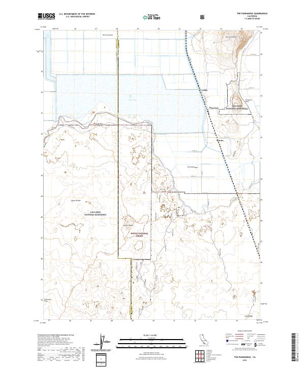
2021 Map of The Panhandle
USGS Topo · Published 2021About this map
Tule Lake National Wildlife Refuge and Lava Beds National Monument converge in this northern California landscape, where the Siskiyou and Modoc county lines meet. The terrain transitions from the open waters and reclaimed agricultural lands of Tule Lake to the volcanic features of the south, including the Schonchin Flow and Hospital Rock. Small settlements like Liskey, Hannchen, and Kandra are situated along a network of county roads and the J Canal, reflecting the area's complex water management history. In the high ground, the Modoc National Forest protects the timbered slopes around Juniper Butte. This survey provides a modern look at the preservation of both wetland habitats and geological landmarks like Prisoners Rock, while tracing the local infrastructure connecting these remote communities through routes like Rim Rd and the Lyons Trail.
Find a feature on this map
39 named features on this map. Tap any name to fly to it.
Don’t see what you’re looking for? This feature index may not catch every label — zoom into the map to look around manually.
Map Details
Editions of this 2021 The Panhandle Map
This is the sole edition of this map. No revisions or reprints were ever made.
Other maps of this area

1886 · Modoc Lava Bed
USGS Topo · 1:250,000

1892 · Modoc Lava-Bed
USGS Topo · 1:250,000

1950 · Mt. Dome
USGS Topo · 1:62,500

1951 · Tulelake
USGS Topo · 1:62,500

1952 · Timber Mountain
USGS Topo · 1:62,500

1952 · Medicine Lake
USGS Topo · 1:62,500

1954 · Alturas
USGS Topo · 1:250,000

1958 · Alturas
USGS Topo · 1:250,000

1962 · Alturas
USGS Topo · 1:250,000

1965 · Alturas
USGS Topo · 1:250,000