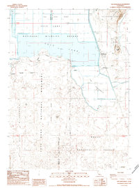
1988 Map of The Panhandle
USGS Topo · Published 1988About this map
Lava Beds National Monument dominates the western portion of this landscape, where volcanic terrain meets the managed waters of the Tule Lake basin. The map illustrates a highly engineered environment where the Tule Lake National Wildlife Refuge and Modoc National Forest converge. Agriculture and industry are concentrated along the eastern edge, marked by the Hannchen Grain Elevator and Kandra Grain Elevator, reflecting the region's reliance on grain production and rail transport via the Tlnwr. Notable landmarks like Prisoners Rock and the historically significant Captain Jacks Stronghold stand out against the backdrop of Tule Lake and The Peninsula. This 1980s data shows the precise management of the water table, including a network of levees and several Pumping Stations that maintain The Panhandle and surrounding refuge lands.
Find a feature on this map
22 named features on this map. Tap any name to fly to it.
Don’t see what you’re looking for? This feature index may not catch every label — zoom into the map to look around manually.
Map Details
Editions of this 1988 The Panhandle Map
This is the sole edition of this map. No revisions or reprints were ever made.
Other maps of this area

1886 · Modoc Lava Bed
USGS Topo · 1:250,000

1892 · Modoc Lava-Bed
USGS Topo · 1:250,000

1950 · Mt. Dome
USGS Topo · 1:62,500

1951 · Tulelake
USGS Topo · 1:62,500

1952 · Timber Mountain
USGS Topo · 1:62,500

1952 · Medicine Lake
USGS Topo · 1:62,500

1954 · Alturas
USGS Topo · 1:250,000

1958 · Alturas
USGS Topo · 1:250,000

1962 · Alturas
USGS Topo · 1:250,000

1965 · Alturas
USGS Topo · 1:250,000