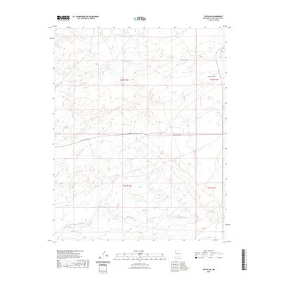
2023 Map of The Pillar
USGS Topo · Published 2023About this map
Moncisco Mesa dominates the northeastern reaches of this high-desert landscape in the northwestern corner of New Mexico. This region is defined by its deep arroyos and wide washes, which drain the vast tablelands during seasonal rains. The map traces the path of Brimhall Wash in the south and Pinabete Arroyo further north, showing how these natural drainage systems have carved the local geography. Transportation through this part of the San Juan County backcountry is facilitated by Indian Svc Rte 5, which provides a vital east-west corridor across the central portion of the quadrangle. These routes and waterways illustrate the enduring patterns of movement and water management in a high-elevation arid environment, where Moncisco Wash also serves as a prominent landmark for navigation and historical land use.
Find a feature on this map
9 named features on this map. Tap any name to fly to it.
Don’t see what you’re looking for? This feature index may not catch every label — zoom into the map to look around manually.
Map Details
Editions of this 2023 The Pillar Map
This is the sole edition of this map. No revisions or reprints were ever made.
Other maps of this area

1889 · Chaco
USGS Topo · 1:250,000

1892 · Chaco
USGS Topo · 1:250,000

1927 · Sulphur Spring
USGS Topo · 1:96,000

1928 · Kirtland
USGS Topo · 1:125,000

1932 · Kirtland
USGS Topo · 1:125,000

1954 · Shiprock
USGS Topo · 1:250,000

1958 · Shiprock
USGS Topo · 1:250,000

1959 · Shiprock
USGS Topo · 1:250,000
1965 · Hugh Lake
USGS Topo · 1:24,000
1966 · Alamo Mesa West
USGS Topo · 1:24,000