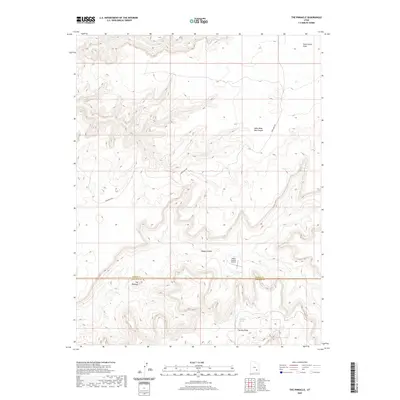
2020 Map of The Pinnacle
USGS Topo · Published 2020About this map
The Pinnacle rises above the border of Wayne and Garfield counties, anchoring a landscape defined by deep drainages and elevated plateaus. The winding course of Happy Canyon cuts through the center of the sheet, supported by the presence of Happy Canyon Airport on a nearby level bench. The terrain is marked by significant topographical shifts between high flatlands like Twin Corral Flats and the narrow, steep-walled Sams Mesa Box Canyon. Transportation is limited to remote corridors such as Sams Mesa Rd and the track simply labeled Happy, which provide access to water sources including Dripping Spring and Two Pipe Springs. This U.S. Geological Survey representation highlights the isolation of The Big Ridge, where the complex canyon systems of southern Utah intersect.
Find a feature on this map
11 named features on this map. Tap any name to fly to it.
Don’t see what you’re looking for? This feature index may not catch every label — zoom into the map to look around manually.
Map Details
Editions of this 2020 The Pinnacle Map
This is the sole edition of this map. No revisions or reprints were ever made.
Other maps of this area

1885 · San Rafael
USGS Topo · 1:250,000

1952 · Orange Cliffs 3 SW
USGS Topo · 1:24,000

1953 · Orange Cliffs 3 SE
USGS Topo · 1:24,000

1953 · Orange Cliffs 4 NW
USGS Topo · 1:24,000

1953 · Orange Cliffs 3 NE
USGS Topo · 1:24,000

1953 · Orange Cliffs 4 SW
USGS Topo · 1:24,000

1953 · Orange Cliffs 3 NW
USGS Topo · 1:24,000

1953 · The Spur
USGS Topo · 1:62,500

1953 · Fiddler Butte
USGS Topo · 1:62,500

1953 · Orange Cliffs
USGS Topo · 1:62,500