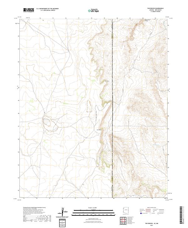
2021 Map of The Rincon
USGS Topo · Published 2021About this map
The Rincon and The Point define this high-elevation landscape along the border of Apache County, Arizona and Catron County, New Mexico. This survey highlights a remote corner of the Southwest where public land survey system lines converge across a sparsely populated terrain. Human impact is visible through the winding path of Co RD a001 and various cattle-related infrastructure like Big Pit Tank. The drainage patterns of Cottonwood Canyon and Mayes Wash indicate the seasonal water flow that shapes these plateaus. This map provides a detailed look at the jurisdictional boundaries between states and counties in a region dominated by vast open space and essential water management features for livestock and local land use.
Find a feature on this map
15 named features on this map. Tap any name to fly to it.
Don’t see what you’re looking for? This feature index may not catch every label — zoom into the map to look around manually.
Map Details
Editions of this 2021 The Rincon Map
This is the sole edition of this map. No revisions or reprints were ever made.
Other maps of this area

1886 · St Johns
USGS Topo · 1:250,000

1892 · St Johns
USGS Topo · 1:250,000

1954 · Saint Johns
USGS Topo · 1:250,000

1957 · Saint Johns
USGS Topo · 1:250,000

1958 · Saint Johns
USGS Topo · 1:250,000

1962 · Saint Johns
USGS Topo · 1:250,000
1968 · Nelson Reservoir NE
USGS Topo · 1:24,000

1969 · Coyote Hills
USGS Topo · 1:24,000

1971 · Mesa Parada NW
USGS Topo · 1:24,000

1971 · Mesa Parada
USGS Topo · 1:24,000