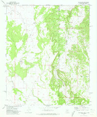
1971 Map of The Rincon
USGS Topo · Published 1973About this map
Cottonwood Canyon cuts through this high desert borderland where the boundaries of Apache County and Arizona and New Mexico meet. The landscape is defined by the vital necessity of water management for ranching and survival, evidenced by several family-named and functional water sources. Landmarks such as Tom Phelps Well, Goldwater Well, and Middle Well indicate the reliance on groundwater in an area dominated by sharp topography like The Point and The Rincon.
Find a feature on this map
14 named features on this map. Tap any name to fly to it.
Don’t see what you’re looking for? This feature index may not catch every label — zoom into the map to look around manually.
Map Details
Editions of this 1971 The Rincon Map
This is the sole edition of this map. No revisions or reprints were ever made.
Other maps of this area

1886 · St Johns
USGS Topo · 1:250,000

1892 · St Johns
USGS Topo · 1:250,000

1954 · Saint Johns
USGS Topo · 1:250,000

1957 · Saint Johns
USGS Topo · 1:250,000

1958 · Saint Johns
USGS Topo · 1:250,000

1962 · Saint Johns
USGS Topo · 1:250,000
1968 · Nelson Reservoir NE
USGS Topo · 1:24,000

1969 · Coyote Hills
USGS Topo · 1:24,000

1971 · Mesa Parada NW
USGS Topo · 1:24,000

1971 · Mesa Parada
USGS Topo · 1:24,000