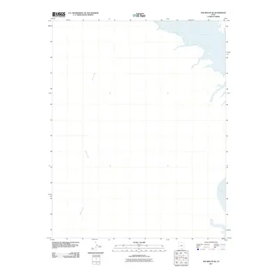
2011 Map of The Rincon NE
USGS Topo · Published 2011About this map
Navajo Creek carves a long path through this portion of San Juan County, flowing toward the expansive waters of Lake Powell in the northeast and southeast corners of the map. This 2011 survey, published by the U.S. Geological Survey, illustrates the modern extent of the reservoir as it fills the deep canyons of the Colorado River drainage system. The map is defined by its dramatic hydrography and elevation contours, which trace the steep verticality of the surrounding landscape. While many contemporary maps focus on human development, this sheet highlights the dominance of the river-fed basin and the natural drainages that define the high desert terrain of southern Utah.
Find a feature on this map
2 named features on this map. Tap any name to fly to it.
Don’t see what you’re looking for? This feature index may not catch every label — zoom into the map to look around manually.
Map Details
Editions of this 2011 The Rincon NE Map
This is the sole edition of this map. No revisions or reprints were ever made.
Other maps of this area

1886 · Henry Mountains
USGS Topo · 1:250,000

1892 · Henry Mountains
USGS Topo · 1:250,000

1953 · Mt Pennell 3 SW
USGS Topo · 1:24,000

1953 · The Rincon
USGS Topo · 1:62,500

1953 · Lake Canyon
USGS Topo · 1:62,500

1953 · Mt. Ellsworth
USGS Topo · 1:62,500

1953 · Hall Mesa
USGS Topo · 1:62,500

1956 · Escalante
USGS Topo · 1:250,000

1960 · Escalante
USGS Topo · 1:250,000
1980 · Hite Crossing
USGS Topo · 1:100,000