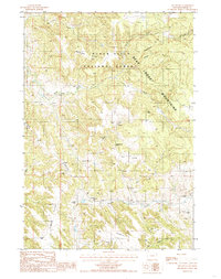
1984 Map of The Rocks
USGS Topo · Published 1985About this map
The Bear Lodge Mountains dominate this 1980s landscape in Crook County, where the high ridges of the Black Hills National Forest are defined by an intricate network of divides. Strategic high points like Montgomery Hill and the distinctive formation known as The Rocks overlook a terrain carved by numerous drainages, including the North Fork, Middle Fork, and South Fork tributaries. The presence of several Artesian Wells and named water sources like Miller Spring indicates the vital importance of water management in this Wyoming upland.
Find a feature on this map
25 named features on this map. Tap any name to fly to it.
Don’t see what you’re looking for? This feature index may not catch every label — zoom into the map to look around manually.
Map Details
Editions of this 1984 The Rocks Map
This is the sole edition of this map. No revisions or reprints were ever made.
Other maps of this area

1898 · Sundance
USGS Topo · 1:125,000

1901 · Aladdin
USGS Topo · 1:125,000

1902 · Sundance
USGS Topo · 1:125,000

1903 · Aladdin
USGS Topo · 1:125,000

1905 · Devils Tower
USGS Topo · 1:125,000

1918 · Moorcroft
USGS Topo · 1:125,000

1954 · Sunny Divide
USGS Topo · 1:24,000

1954 · Gillette
USGS Topo · 1:250,000

1955 · Devils Tower
USGS Topo · 1:62,500

1955 · Gillette
USGS Topo · 1:250,000