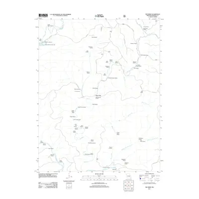
2011 Map of The Sinks
USGS Topo · Published 2011About this map
Mauser Mill stands as a central landmark in this Missouri landscape, situated near the confluence of Big Creek and Brushy Creek. The terrain is defined by a dense network of hollows and bluffs, including Upper Dugan Bluff and Bee Bluff overlooking the Current River. The hydrology of the area is particularly distinctive, featuring The Sinks along Sinking Creek and a series of water management structures like the George Hellmuth Lower Dam. Genealogy researchers will find significant value in the documentation of the Conway Cemetery and Heaton Cemetery, which serve as markers of the families who settled these valleys. The map illustrates a remote, rural infrastructure where named ridges like Polk Ridge and numerous hollows—such as Warren Hollow and Renfro Hollow—dictated the placement of roads and homesteads in the Shannon County backcountry.
Find a feature on this map
83 named features on this map. Tap any name to fly to it.
Don’t see what you’re looking for? This feature index may not catch every label — zoom into the map to look around manually.
Map Details
Editions of this 2011 The Sinks Map
This is the sole edition of this map. No revisions or reprints were ever made.
Other maps of this area

1915 · Eminence
USGS Topo · 1:62,500

1917 · Eminence
USGS Topo · 1:62,500

1928 · Cardareva
USGS Topo · 1:62,500

1944 · Corridon
USGS Topo · 1:62,500

1945 · Round Spring
USGS Topo · 1:62,500

1947 · Sinkin
USGS Topo · 1:48,000

1947 · Corridon
USGS Topo · 1:62,500

1949 · Round Spring
USGS Topo · 1:62,500

1949 · Rolla
USGS Topo · 1:250,000

1949 · Cardareva
USGS Topo · 1:62,500